The ongoing increased threat to biodiversity presence at Kambui Hills Forest Reserve (KHFR) is regarded as an issue of grave concern by both national and regional institutions and individuals. There is evidence of high encroachment and degradation in the Reserve stemming from activities such as massive logging, charcoal production, settlement expansion, mining, poaching, etc. Sustained collaborative efforts are required from all key actors, including state and non-state actors to stop the current spate of lawlessness if it is to be protected and conserved for future generations.
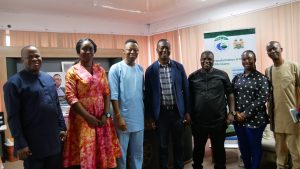
In order to support government and communities to reverse this trend, the Conservation Society of Sierra Leone (CSSL), funded by the EU through the International Union of Conservation of Nature (IUCN) is currently implementing the “Biodiversity and Protection Areas Management (BIOPAMA)” project in the north and south of the KHFR. One of the project’s deliverables is boundary demarcation, ensuring that visible structures in the form of concrete pillars are installed in identified locations around the Reserve. To commence work on this, the BIOPAMA project team held a consultative meeting with key stakeholders to start discussions around the exercise. Paramount Chiefs, Section Chiefs, representatives from the National Protected Area Authority (NPAA), Forestry Division of the Ministry of Agriculture, and other elders from chiefdoms within the Kambui Hills Landscape attended the meeting, organised on 2nd June 2021.
The NPAA’s Manager, Mr. Ansumana Barber Turay who chaired the meeting started off by highlighting how critical it is to demarcate boundaries for the Reserve. He said other protected areas across the country continue to face problems with encroachment and related illegal activities, but emphasised that the KHFR is facing more threats than the others. Barber therefore pleaded with the stakeholders to provide the required support to CSSL and partners in order to ensure a successful boundary demarcation exercise.
The District Forestry Officer (DFO), Mr. Julius Sama also expressed grave concerns over the current status of the Reserve, and emphasised on the ramifications that will follow if the country loses the Reserve. He described the Forestry Division’s critical role of monitoring all activities in and around the Reserve and other sites across the country. Mr. Sama also registered his disappointment about the location of government offices and private buildings in the forest reserve area. He concluded by asserting that a clearly defined and agreeable boundary is important in order to avoid impunity – defaulters will be dealt with in accordance with stipulated laws. Various speakers, including the Paramount Chief of Koya chiefdom, PC Alamin Kanneh, expressed similar sentiments. They further raised concern regarding payment of royalties to the respective chiefdoms that host the Reserve and the functionality of the governance structure of KHFR.
Using the Google Earth Pro software, the NPAA’s GIS Specialist, Isaa Gassama projected satellite images of the Reserve for all to see the original boundary points and current level of encroachment and degradation. This presentation helped stakeholders to vividly see the high level of destruction people have perpetrated on the KHFR and thus, the relevance of the proposed boundary demarcation exercise. They therefore strongly expressed commitment to support the entire activity. They further requested CSSL and partners (NPAA and Forestry Division) to notify them before the commencement of the demarcation exercise for communities to be fully informed and for them to provide the much-needed local support.

![]()